Glossary
Geocoding
What is Geocoding?
Geocoding means the process of converting a physical address into geographic coordinates, typically latitude and longitude, which can be used to plot the location on a map. It basically acts as a translator between textual descriptions and spatial data. Here's a breakdown of its key aspects:
What does geocoding involve?
Geocoding will typically involve the following steps:
- First, it takes various inputs: These inputs are typically your usual inputted information from form fields: address (street, city, state, postal code), place name, landmark, building name, etc.
- Next up, it'll match these against databases: This means matching the input to a large database of geographic information. Often, that will come from national mapping agencies or commercial providers.
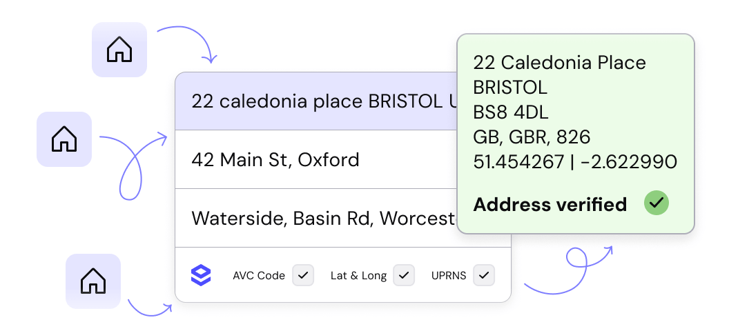
- Then, we get outputted coordinates: These coordinates will return the corresponding latitude and longitude coordinates for the location (a process called Geolocation).
- Additional data is possible: Depending on the service, additional information like altitude, bounding box, or region code might be provided. And yes, Loqate does all of that... but we don't like to brag.
Why is geocoding important?
Geocoding is a critical element for any successful address capture and validation process, for the following reasons:
- Visualizes data: Geocoded data is data you can use to plot data points on maps for analysis, visualization, and understanding spatial relationships.
- Enables location-based services: Location-based services are handy for a lot of business purposes, from route planning to ride-sharing, or delivery tracking to emergency response.
- Improves data analysis: Geocoding your data means you'll have access to enhanced data insights, associating locations with other key information.
What are the different types of geocoding?
There are a few different types of geocoding to be aware of:
- Forward geocoding: Or 'regular geocoding' (the type that's generally referred to with the simple phrase 'geocoding'). This turns an address or place name into coordinates.
- Reverse geocoding: As the name implies, this is the reverse process of forward geocoding. It converts coordinates into an address or place name. Learn more: What is reverse geocoding?
- Batch geocoding: As the name implies, batch geocoding is when you processes multiple addresses at once into geocodes.
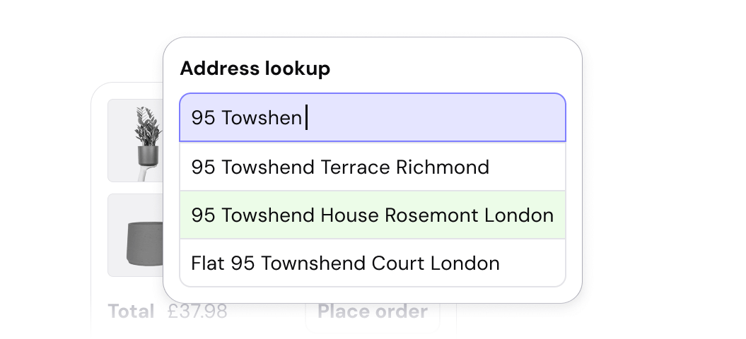
- Interactive geocoding: Provides suggestions as the user types an address (such as with Loqate's very own type-ahead address validation solution, which uses geocodes).
How to choose a geocoding service
Choosing a geocoding service can be difficult, as there are a lot of different options and providers out there. Here are the key criteria to bear in mind:
- Data accuracy: We may be stating the obvious, but it's paramount to pick a service with reliable and up-to-date location data. Different levels of precision might be available, depending on the service and data source - it's always worth asking prospective providers about this.
- Coverage: Ensure the service covers the geographic areas you need. Loqate sets the standard in this department, with our coverage of over 249 different countries and territories.
- Cost and usage limits: Different services have varying pricing models and usage limitations.
Overall, geocoding plays a crucial role in various applications by bridging the gap between textual descriptions and spatial data, unlocking the power of location-based analysis and visualization.
For an easy-to-install and fully comprehensive geocoding service, look no further than Loqate Geocode. If you're ready to see it in action, don't hesitate to book a demo with our friendly and experienced team, who will guide you through how we can meet your requirements.
Discover Loqate's suite of products:
Capture
Ensure a seamless customer experience with accurate location data.
Verify
Improve operations with high-quality address data.
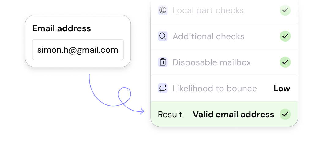
Email Validation
Improve email delivery rates and drive effective communications.
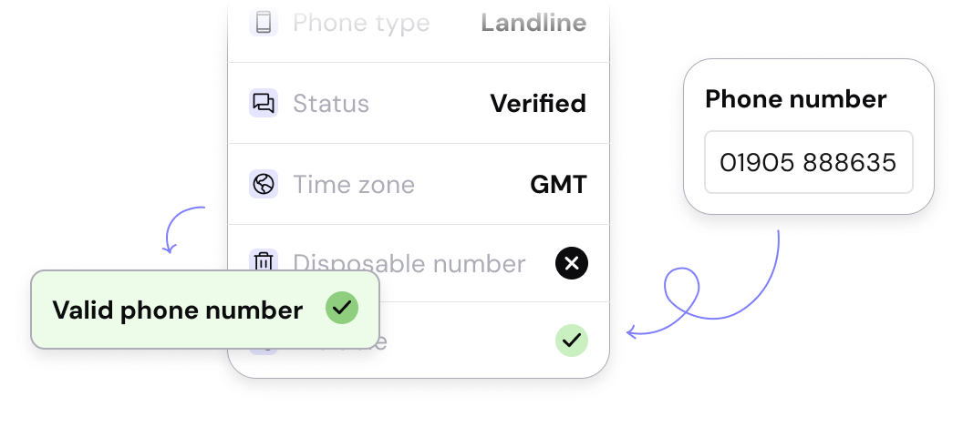
Phone Verification
Avoid additional spending and strengthen account security.